Pacific sea-surface temperatures have already topped the 2015 benchmark weeks before the event’s expected peak, and scientists say familiar risks are arriving early.
By The Daily Atlantic Staff
September 22, 2026
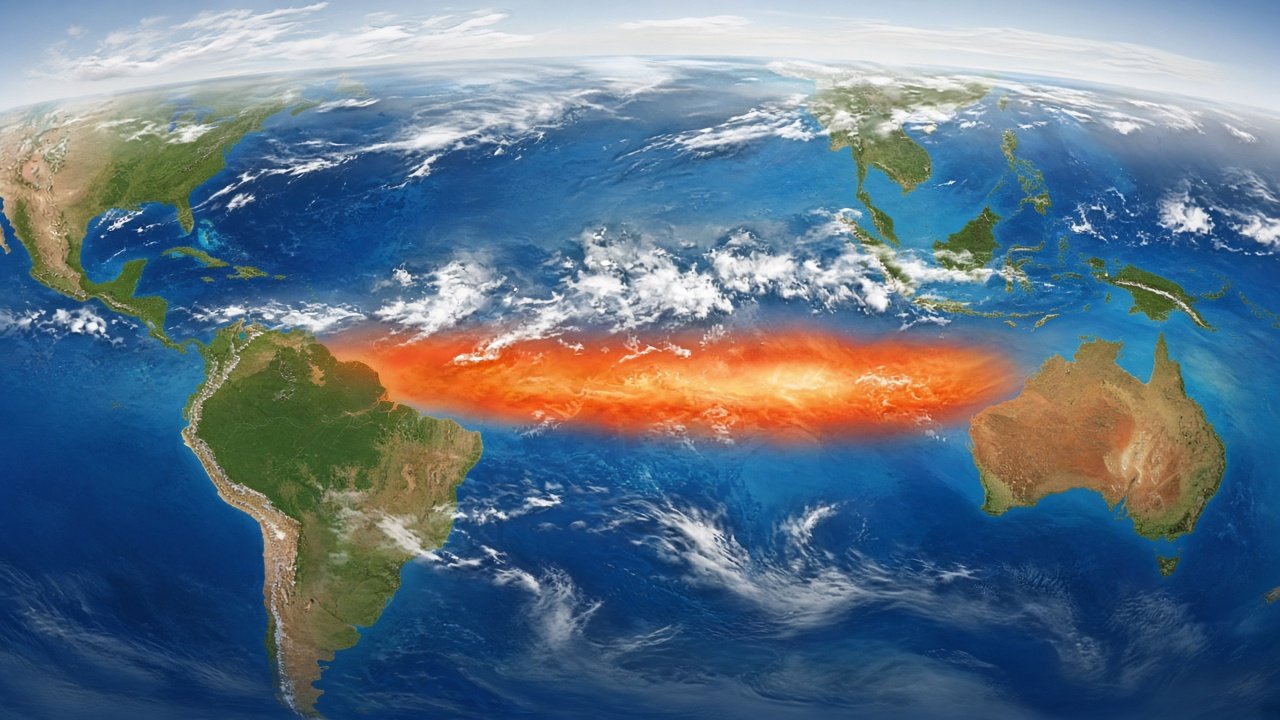
Nature does not issue press releases, but the Pacific Ocean has delivered something close to one. Scientists tracking a key stretch of the central-eastern equatorial Pacific report that daily sea-surface temperatures there reached 3.05 degrees Celsius above average on September 19 — edging past the 3.02-degree mark set during the powerful El Niño of 2015. The record arrives weeks before the phenomenon is expected to peak later this year, a timing detail that has unsettled forecasters who already warned that 2026’s event could be exceptional.
El Niño is a recurring climate pattern, not a one-off storm. Roughly every few years, trade winds that normally push warm water westward weaken or reverse. Warm water spreads east, heat rises into the atmosphere, and weather systems around the globe shift in response. When the signature ocean region stays at least half a degree above normal for long enough, an El Niño is declared. Strength is another question entirely, and this year’s readings are answering it loudly.
Not every yardstick tells the same story. Some longer-term indices have not yet broken all-time records, and a relative measure that accounts for background ocean warming — used by many U.S. and Australian forecasters — shows the event as extreme for late September without yet crowning it the strongest ever on that particular scale. Those nuances matter in scientific debate. For farmers, city managers, and emergency planners, the practical message is simpler: the Pacific is unusually warm, the peak is still ahead, and historical analogs point to higher odds of disruptive weather.
Those odds are already turning into on-the-ground reports. El Niño years often bring a weaker Indian monsoon; India’s meteorological data through September 22 show southwest monsoon rainfall running about 15 percent below normal. Atlantic hurricane formation has been suppressed by atmospheric wind patterns linked to El Niño, and 2026 has yet to see an Atlantic hurricane — a satellite-era record for how late the season has gone without one. Elsewhere, the risk ledger flips the other way: coastal flooding concerns rise for parts of Ecuador, Peru, and the southern United States, while drought and wildfire threats intensify across regions of Brazil, Australia, and Indonesia. Indonesian health authorities have already linked El Niño–fueled wildfires to impacts affecting millions of people.
The United Kingdom Met Office’s Adam Scaife has described the developing event as one forecasters flagged for months as potentially unprecedented, noting that exceeding prior records before the peak underscores its scale. Climate scientist Daniel Swain has likewise warned that this may rank among the most dramatic El Niño episodes of living memory. Strong El Niño years also tend to nudge global average temperatures upward, raising the chances that 2026 and 2027 join the ranks of the hottest years on record — a compounding problem on a planet already running a fever.
None of this means every expected impact will arrive at maximum intensity. Each El Niño has its own personality, and scientists are still assessing whether weather consequences will scale in direct proportion to ocean heat. What is already clear is that preparation cannot wait for the peak. Crop planners watching monsoon shortfalls, utilities bracing for heat and storm swings, and communities in fire-prone landscapes all face decisions now, not in December.
The larger environmental frame is sobering. Separate assessments this month, including United Nations Environment Programme analysis on temperature overshoot and a Planetary Health Check finding that seven of nine planetary boundaries are breached, underscore how natural variability and human-driven warming interact. El Niño does not create climate change, but it can amplify its felt effects — hotter extremes, stressed ecosystems, and thinner margins for adaptation.
In newsroom terms, the story is not only the broken number on a Pacific thermometer. It is the chain of consequences that number sets in motion: food prices, insurance claims, public-health alerts, and the quiet work of resilience planning in places that rarely make front pages until a flood or fire arrives. As this El Niño builds toward its late-year crest, the responsible posture is vigilance without fatalism — monitoring the data, funding preparedness, and recognizing that the ocean’s record is already rewriting the season’s odds.
Sources: BBC Weather (https://www.bbc.com/weather/articles/cmvgy4nv9d62o); Scientific American (https://www.scientificamerican.com/article/this-years-el-nino-just-broke-another-sobering-record/); UNEP (https://www.unep.org/news-and-stories/press-release/unep-world-set-cross-15degc-global-warming-can-still-limit-adapt-and); Potsdam Institute for Climate Impact Research / Planetary Health Check 2026 (https://publications.pik-potsdam.de/pubman/faces/ViewItemFullPage.jsp?itemId=item_35009_3&view=EXPORT)